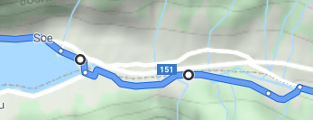
I'd like to have a customised route available on my phone for turn-by-turn navigation. BY customised I mean an A-to-B-to-C-to... itinerary that has been dragged at various points along the route, starting from the originally computed itinerary. Detour points added by dragging are represented by large white dots:
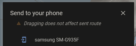
Unfortunately, as it stands now, Google Maps does not allow sending this to the phone without removing all detour points defined by dragging:
One workaround is to redefine each detour point not by dragging but by adding its specific location (address, or lat/long), in which case the custom itinerary can be sent to the phone as-is. This has to be within the limit of no more than 10 named detour points, but then again the same limit also applies to dragged detour points, before the message "Route cannot be modified further" comes on.
The problem is that, for long tours, while you're on the road, if you accidentally do an extra back tap on your phone, the entire itinerary is lost, and the only way to get it back is to use the "send to phone" command on an online computer, which may not be available.
Any solutions based on Google My Maps don't seem good, as they all lack turn-by-turn navigation. Even more advanced options such as saving the tour as a GPX are out of the question if you're going to navigate with Google Maps Android, as it does not do GPX.
Is there any way (even hacky) to retrieve the custom itinerary directly from the phone, without the need to send it from the computer?


